Aerial Mapping and Surveying
Aerial Mapping and Surveying
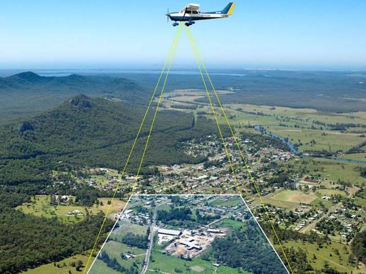
Himalayan Droneshala strives to provide clear-cut Aerial Drone Surveying/Mapping services across India. From having served the Government and Private sector in Land Surveying, Aerial Surveying for Land Management & Development, Land Slope monitoring, Stockpile volumetric measurements, Designing smart cities, Mapping greenfield projects, etc. our experience remains unsurpassed. Equinox's Drones prioritizes quality and, thus, perpetually continues to achieve highly accurate topographic maps with Centimeter level Accuracy at any given time. Adorned with state-of-the-art surveying drones and a team of expert licensed pilots, our clients can access deliverables with greater speed, thereby facilitating more nimble decision-making processes.
Deliverables we provide:
Orthomosaic maps
3D point cloud
Digital surface models (DSM)
Digital Elevation Model (DEM)
Digital Terrain Model (DTM)
CONTOUR MAPS
3D Textured Maps
Book NowWe can help with
Land Surveying
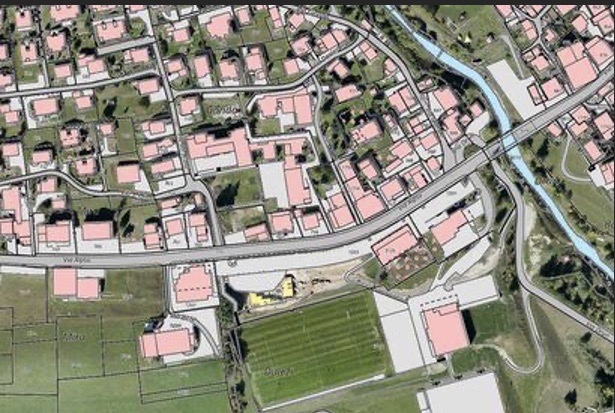
Our nationwide and tailored service of drone surveying enables us to procure precise topographic maps and 3D models of areas with unaccessible evidence. Extensive land surveys and topographical surveys permit the most definite representation of cadastral maps, immediately and in a hassle-free manner. Our GIS crew then post-processes the data with photogrammetry software to generate deliverables like a detailed Digital Elevation Model (DEM), Digital Terrain Model (DTM), contours, brake lines, ortho-mosaic/ortho-imagery,interactive 3D Mode, and 3D reconstructions of land sites or buildings.